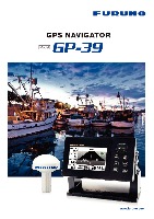
Features
-
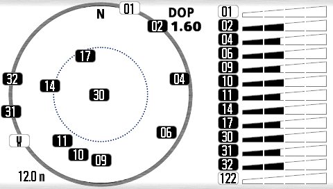
Newly designed GPS core delivers enhanced position fixing accuracy
-
4.2" high-resolution color LCD
-
Storage for 3,000 track points, 10,000 waypoints and 100 routes
-
SBAS capable for better positioning calculations
-
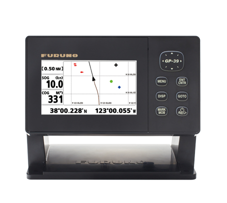
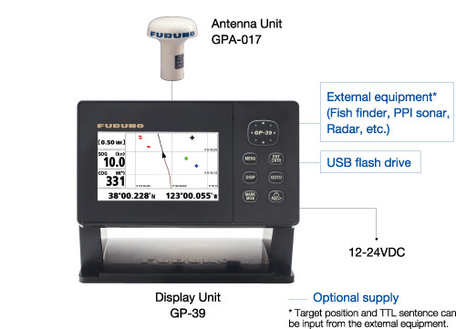
Share and display position information on networked equipment such as a fish finder, sonar, radar, etc.
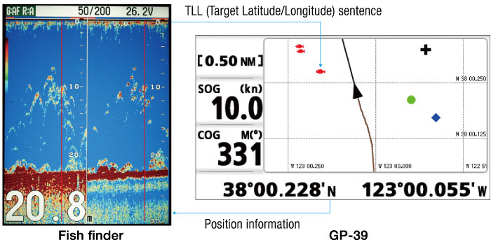
The GP-39 delivers the position information to an interfaced fi sh finder or sonar. Also, the GP-39 receives the TLL (Target Latitude/Longitude) sentence from networked fish fi nders or sonars and can display the received information. This allows you to mark fish school locations easily. -
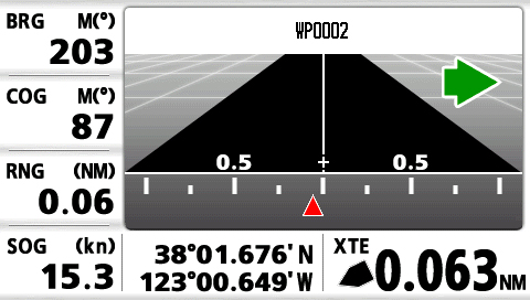
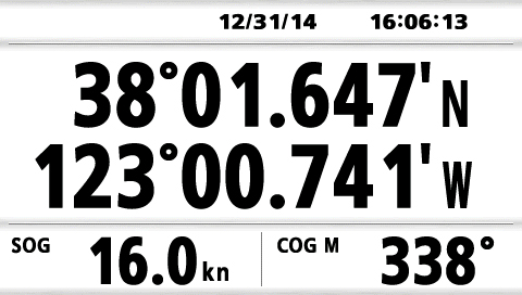
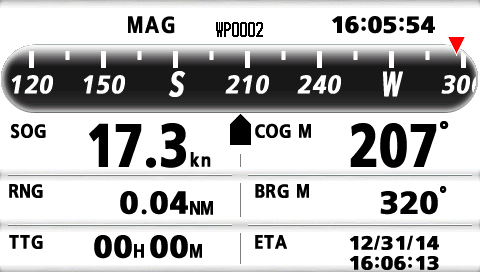
7 display modes available, including 2 user-customizable modes
-
Waypoint and route data can be exported/imported via a USB flash drive or signal converter
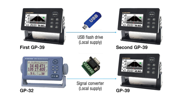
Waypoint, route data and setting information can be exported/imported via a USB ash drive between GP-39 units. The waypoint and route data in GP-32 can be transferred to GP-39 by means of signal converter. You can backup information, or share useful information between vessels. -
Multi-language ready : English, French, Spanish, Chinese, Vietnamese, Malay, Indonesian and Thai
-
Easy to mount on/off the bracket
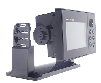
The improved hanger allows the display unit to be mounted or un-mounted easily. The display unit can be carried in the bag (standard supply).
.jpg)
Specifications
Display Unit
- Screen Type
- 4.2" Color LCD
- Screen Resolution
- 480 (V) x 272 (H) pixels
- GPS Antenna
- External
- Display Modes
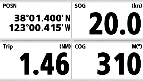
- Plotter, Highway, Steering, NAV Data, Satellite monitor, User Display (Digital, Speedometer, COG)
- Language
- English, French, Spanish, Chinese, Vietnamese, Malay, Indonesian, Thai
GPS / SBAS (WAAS/EGNOS/MSAS)
- Receiving Type
- GPS: 12 channels parallel, 12 satellites tracking, C/A code, all-in-view
SBAS: 2 channels - Receiving Frequency
- L1 (1575.42 MHz ± 1.023 MHz)
- Accuracy
- GPS: 10 m (95% of the time, HDOP≤4)
WAAS: 3 m (95% of the time, HDOP≤4)
MSAS: 7 m (95% of the time, HDOP≤4)
PLOTTER
- Memory Capacity
- 3,000 ship's track points
10,000 waypoints with comments
100 routes with 30 waypoints/route
OTHERS
- Waterproofing
- Display unit: IP55
Antenna unit: IP56 - Power Supply
- 12-24 VDC : 0.7-0.3 A
- Weight
- 0.86 kg (Bracket mount)
Interconnection Diagram
Equipment List
Standard
- Display unit GP-39
- Antenna unit GPA-017 with cable 10 m
- Plastic bag
- Standard spare parts and installation materials
Option
- Mast mounting kit
- Flush mount kit