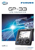
Features
-
4.3" "Sunlight Viewable" color LCD (Brightness: 700 cd)
-
Enhanced data legibility thanks to large characters and high resolution visual aid
-
Stores up to 10,000 marks/waypoints, 100 routes and 3,000 track points
-
7 display modes available, including 2 user-customized modes
-
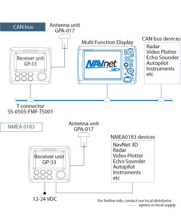
Supports both NMEA0183 and CAN bus interface
-
Contact closure capability available on the 10P connector
-
SBAS capable for better measurement
-
-
Easy Operation
 Innovative digital graphic displays and intuitive on-screen menu structure provide simple operation and easy access to the features you use most frequently.
 -
What is CAN bus?
 CAN bus is a communication protocol that shares multiple data and signals through a single backbone cable. You can simply connect any CAN bus devices onto the backbone cable to expand your network onboard. With CAN bus, IDs are assigned to all the devices, and the status of each sensor in the network can be detected. All the CAN bus devices can be incorporated into the NMEA2000 network.
 -
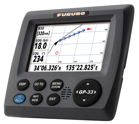
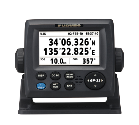
Various Displays
The GP-33 provides navigation data and displays them in a wide variety of numerical and graphical formats. You may freely select which data you want displayed with easy to use controls. The combination of a high resolution screen and large data fields makes the screen easy to read in almost any condition.

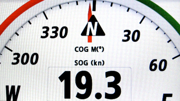
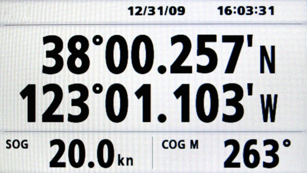
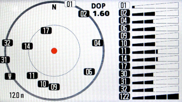
NAV data
The nav data display shows receiver status, position in latitude and longitude (or TDs), course over ground, speed over ground, date and time.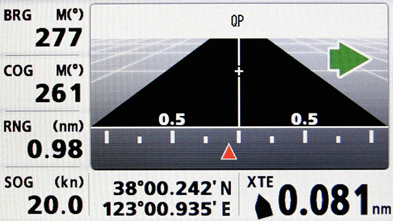
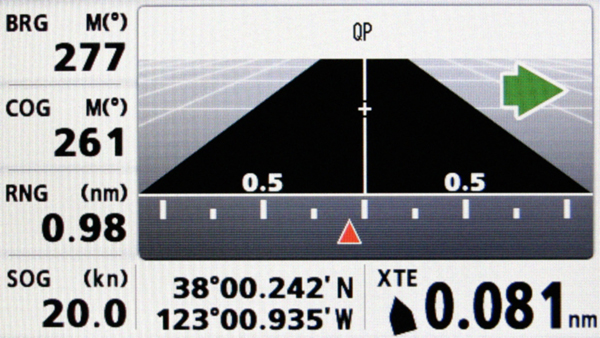
Highway
3-D view of own ship’s progress toward destination (waypoint). This mode is best used for navigation when a straight line course can be followed.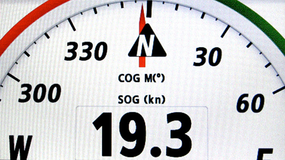
COGEasy to read digital compass heading display that greatly assists you in maintaining a desired course.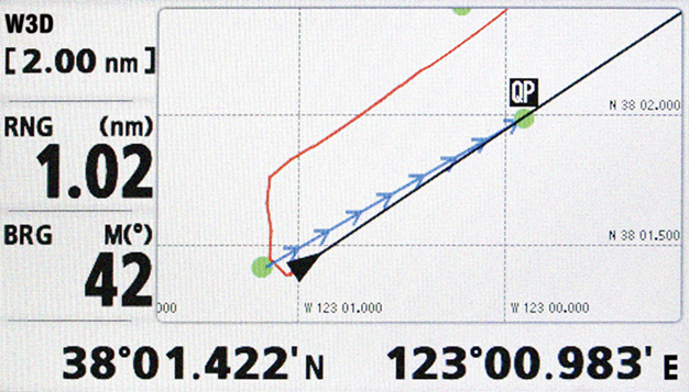
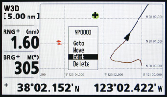
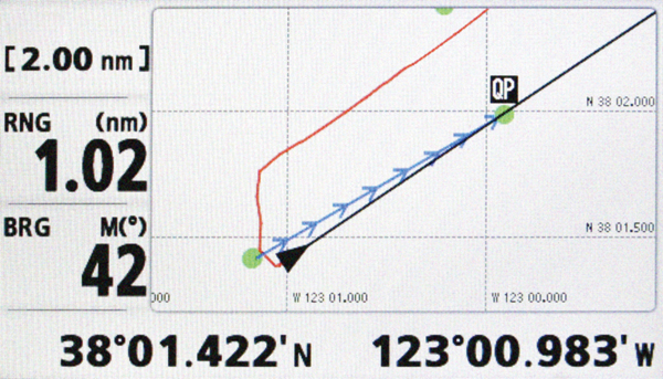
Plotter
shows position on a 2-D map*. This mode presents various data and information with graphic symbols and icons, rather than text.
The Auto Waypoint Entry function plots ship’s track as “WAYPOINTS”. The user may define waypoint entry by time interval, tack angle, etc.
*The unit does not include charts.
User Display
You choose what data is displayed in the User Display Mode.
Screenshots

Specifications
Display Unit
- Screen Type
- 4.3" Color LCD
- Screen Resolution
- WQVGA 480 x 272
- GPS Antenna
- External
- Display Modes
- Plotter, Steering, Highway, NAV data,User display1, User display2, Satellite Monitor Display
- Language
- English, French, Spanish, German, Italian, Portuguese, Danish, Swedish, Norwegian, Finnish
GPS / SBAS (WAAS/EGNOS/MSAS)
- Receiving Type
- Twelve discrete channels, C/A code, all-in-view
- Receiving Frequency
- 1575.42MHz
- Accuracy
- GPS: 10 m, MSAS: 7 m, WAAS: 3 m
PLOTTER
- Memory Capacity
- 3,000 ship's track points
10,000 waypoints with comments
100 routes, 30 waypoints/route
OTHERS
- Waterproofing
- Display unit: IP56, Antenna unit: IPX6
- Power Supply
- Non CANbus: 12-24 VDC, 0.24-0.12 A
CANbus: 15 VDC, LEN7 - Size
- 146 (H) x 172 (W) x 88 (D)
- Weight
- 0.7 kg (Bracket mount)
Interconnection Diagram
Equipment List
Standard
- DISPLAY UNIT GP-33-E1 UNIT
- ANTENNA UNIT GPA-017
WITH 10M CABLE1 PC - CABLE M12-05BM+05BF-060 (6 M)1 PC
- HARD COVER1 PC
- INSTALLATION MATERIALS AND SPARE PARTS1 SET
Option
- JUNCTION BOXFI-5002
- CABLE ASSEMBLY
- NMEA2000 LIGHT CABLE ASSY1 M
2 M
6 M